March 23, 2021 | Neighbourhoods
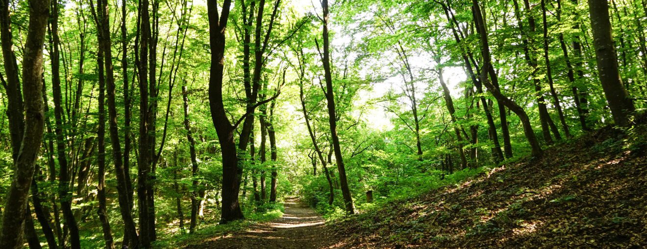
Exploring the Humber River Trail This Spring

Spending spring in Toronto’s west end is a genuine joy. After our long, cold Canadian winters it’s easy to forget just how naturally beautiful the west end’s public parks and green spaces are.
From the cherry blossoms in High Park to the beaches and bike paths along the waterfront, and of course, the spectacular Humber River Trail, there are a seemingly endless amount of family-friendly activities you can enjoy once again come springtime.
Here at Nested, we’re particularly excited about being able to enjoy one of our most favourite outdoor west end destinations this spring, the Humber River Trail. With so many scenic bends and grooves along this 8.2-kilometre-long recreational trail, there’s a new adventure to be had on every trip to the Humber River, which is why we love exploring it so much.
If you want to find out more about the Humber River Trail and our favourite ways to enjoy it in spring, our guide below is for you.
Where Is It?
One of the two major rivers leading into the City of Toronto, the 100-kilometre-long Humber River flows down from the Niagara Escarpment, located northwest of Toronto, all the way through to Lake Ontario.
The mouth of the river divides Toronto’s Swansea neighbourhood and the Queensway neighbourhood, leading straight into the body of Lake Ontario. For us west enders, we commonly refer to the southernmost 30 kilometres of the river between the shores of Lake Ontario and the northern limits of the city as our portion of the Humber Bay River.
Whether you’re on the east or west side of the river, however, you can expect to see an abundance of greenery, wildlife, and breathtaking natural beauty.
How Do I Get There?
Because the Humber Bay River is so long, there are many convenient and easily-accessible entry points to the beautiful trail along the shores of the river. One of the best ways to explore the Humber River Trail is to start from the lakeshore, where the full set of paved public pathways and trails allow for about 100 kilometres of off-road adventures.
If you’re a little further north from the lakeshore, say towards Bloor West Village, another great entry point is to exit west off of Old Mill Drive when you get to Catherine Street, which will lead you towards the iconic Old Mill Bridge. If you are taking public transit, look out for the signs directing you just north and then east towards the Humber Bay River after exiting the charming Old Mill Subway Station. This will lead you directly toward the Old Mill Bridge.
Whichever route you prefer to take, there will be many signs and entry points along the full length of this west end river you can utilize to enter the multi-use paved pathways.
What’s To Do?
We love taking advantage of the beautifully maintained Discovery Walks pathways along the Humber River Trail, which offer a plethora of self-guided routes connecting all of the public parks, green spaces, gardens, and ravines in the area toward the trail.
These publicly-accessible trails follow the multitude of pathways that branch off along the river, which total up to about 50 kilometres of paths to explore. Whether you’re hiking, biking, walking, or running, these Discovery Walks are made accessible all year long and are also dog-friendly, however, they must be kept on a leash at all times.
Additionally, there are more than 60 species of fish that populate the Humber Bay River, which can be commonly spotted from the river shores or atop the river itself, perhaps on a Humber By Canoe trip.
Don’t Miss
Some of our favourite spots to take in the spectacular views of the Humber Bay River are:
- The Humber Bay Arch Bridge — also known as the Humber River Arch Bridge or Gateway Bridge is one of the city’s most iconic bridges, which runs is about 100 metres long and covers the mouth of the Humber River along Toronto’s lakeshore. This pedestrian and bicycle-friendly bridge is part of the Martin Goodman Trail, which runs parallel to Toronto’s northern shores of Lake Ontario.
- The Humber Marshes — located right beside the stretch of Bloor Street West that runs west of Jane Subway Station, the Humber River Marshes is a beautiful waterside park and wildlife habitat and is one of the last remaining river mouth marshes in the city. Stop by this large patch of riverside marshland and look out for the various ducks, turtles, and fish that live there.
- The Old Mill Bridge — Head just north of the Humber Marshes towards King’s Mill Park North (west bank of the river) or Etienne Brulé Park (east bank of the river) and you’ll find signs directing you toward the historic Old Mill Bridge. Originally constructed in 1916, this stone bridge is a sight to behold in itself, and overlooks a spectacular strip of the Humber River Trail.
Are you interested in moving to Toronto’s west end to take advantage of the countless opportunities to explore our outdoor areas? Our team of west end real estate experts can help connect you with the perfect home for you — like 23 Bradley Avenue in Upper Baby Point. To get your west end home search started this spring, simply contact us here today.

Our West End Expertise
We know West Toronto like the back of our hands. From real estate to restaurants to neighbourhoods, we have the intel you need to know. Learn more about our local expertise here.


